This week, we have loads of geoscience-y favourites. Between great Jupyter widgets, augmented reality and a huge new dataset to play with, in the Friday Faves. Geoscience and Python Martin Renou gave a fantastic talk about Jupyter Voila at EuroScipy. He tweeted out their newest developments in iPyLeaflet, which brings GIS capabilities to Jupyter. Once […]
Category Archives: Maps
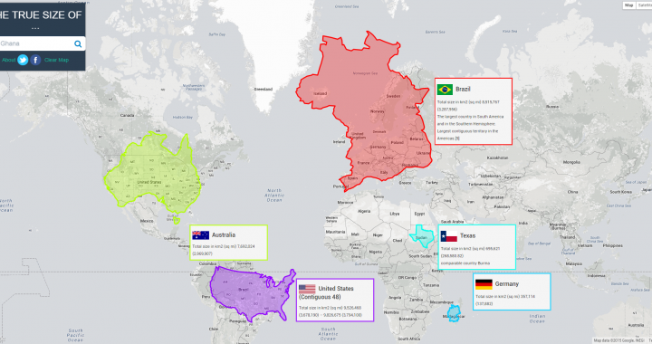
The True Size of Countries
The true size of countries changes our perception of the world. Maps have so many uses in modern society. Google Maps and the navigation included were the main reason I got my first smart phone. But maps have one significant flaw. Every map is a projection of a 3D object onto a 2D plane. That […]
Beasties of fur and of feather
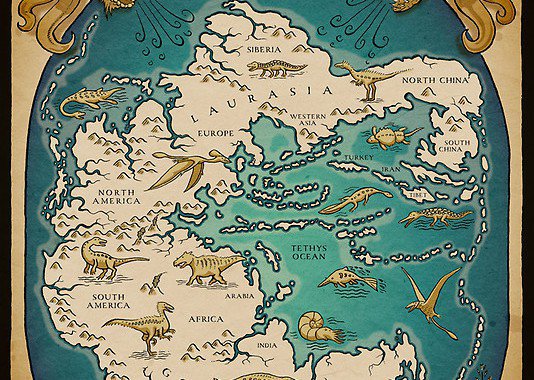
Our world long ago with lands joined together when first appeared beasties of fur and of feather. Artistic view on the life in the Triassic period by Richard Morden. Get it here! (All copyright belongs to him!) This artistic map shows the supercontinent Pangaea and the Tethys ocean. It’s a surprisingly accurate depiction where the […]
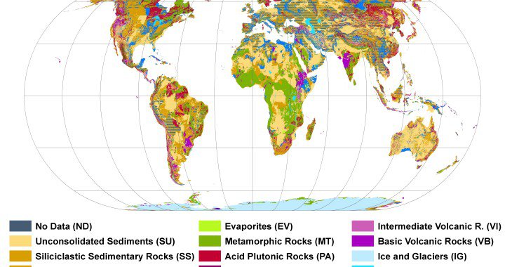
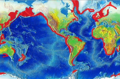
A Global Lithological Map
It’s colorful, it’s huge and it’s a hundred times more detailed than its predecessors. <span class=”removed_link” title=”http://www.vis.klimacampus.de/2270.html&amp;L=1″>http://www.vis.klimacampus.de/2270.html?&amp;L=1</span> It’s a new lithological map of the worldHartmann, J., & Moosdorf, N. (2012). The new global lithological map database GLiM: A representation of rock properties at the Earth surface Geochemistry Geophysics Geosystems, 13 DOI: 10.1029/2012GC004370. The map is […]
Interdisciplinary Upwelling
Have a look at the map. It shows the worldwide upwelling areas (by NCEP and NOAA). Upwelling in coastal areas has been known for quite a while. However, this is a beautiful example how different systems of the earth interact and make living possible. Upwelling is a very important nutrient provider, transporting low, cold, nutrientrich […]