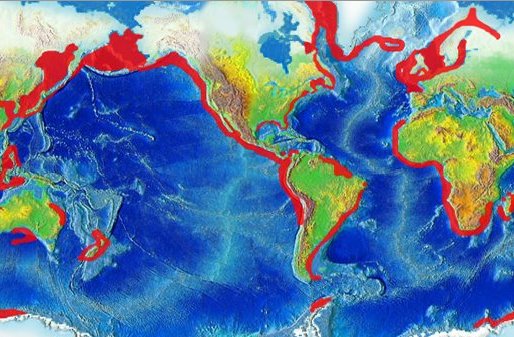
Have a look at the map. It shows the worldwide upwelling areas (by NCEP and NOAA).
Upwelling in coastal areas has been known for quite a while. However, this is a beautiful example how different systems of the earth interact and make living possible. Upwelling is a very important nutrient provider, transporting low, cold, nutrientrich water upwards. But how does this work?
It actually starts with wind.
A nice breeze parallel to the coast works wonders. Let’s take the example of Peru. The wind transfers its momentum to the upper layer of the ocean and now something very interesting happens. The water decelerates with increasing depth and the Coriolis effect kicks in. The direction of the transport of water changes in a spiral with depth. (Read more http://bit.ly/JCbZKB) But the net transport of water happens 90? to the left of our wind motion. Now that we have some motion in the upper water column, flowing away from the coast of Peru and water from below starts flowing upwards.
So we have a combination of wind (meteorology), fluid dynamics (oceanography), and our rotating earth, providing the fauna at the coasts with fresh nutrients. Isn’t that great?
Want to learn more:
http://1.usa.gov/KqP8Tr
http://bit.ly/LqMStv
-JSD
Jesper Dramsch
Latest posts by Jesper Dramsch (see all)
- Juneteenth 2020 - 2020-06-19
- All About Dashboards – Friday Faves - 2020-05-22
- Keeping Busy – Friday Faves - 2020-04-24

