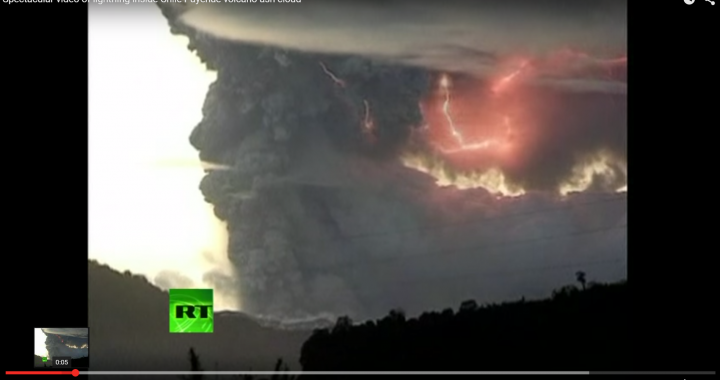
Volcanoes are being monitored for quite some time now. Deformational changes and seismicity can be recorded with decent accuracy. However, the link to volcanic activity has been unclear the entire time. But recent research might shed light on this matter. Let’s take a quick tour under some volcanoes. Down below When we look into the […]

The difference of a decimal for a tsunami
Off the coast of Chile a strong shallow earthquake triggered a tsunami. Warnings have been going out to Chile, Peru, Hawaii and New Zealand. The first estimation of the energy of the earthquake was at M7.9 but was then corrected to 8.3. This correction results in an update of the tsunami predictions. I created this […]

Rethinking the Common Reflection Surface Processing Tool
I worked with the seismic processing algorithm Common Reflection Surface for the past years. During this time I have come to the following conclusion: CRS has a marketing problem. I have worked with CRS in university, at Fugro Seismic Imaging and Wester Geco, respectively Schlumberger. Its development is closely tied to advanced concepts like the […]

Become a scientist!
This beautiful shirt tells it how it is. Except maybe that rarely any invention is named after the one who found it anymore.
Science needs you. Become a scientist! The benefits are clear:
- Work on your free weekends
- Incredibly low wages
- Study cool stuff
- Wear a lab coat
Your mileage may vary. Yay Science!
I find it hard to believe that it his come so far that the poor state of science has made it onto mass produced t-shirts.
That shirt sums up being a scientist pretty well… http://t.co/nIpkbmXJ7V pic.twitter.com/ZFnpnQlCxZ
— Jesper Dramsch (@JesperDramsch) August 28, 2015
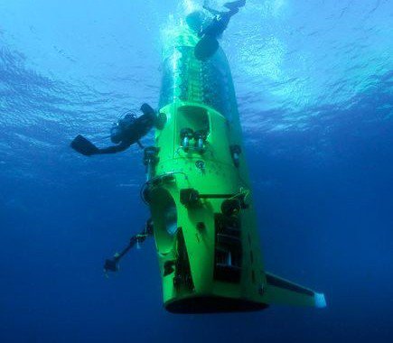
Exploring Challenger Deep
The Challenger Deep at the Marianna trench is the deepest point on earth measuring 10.91km. People used to think our oceans were pretty flat underneath the water and did measurements with a plumb. So when surveyors came to this particular point at this subduction zone the line proved to be too short. When tectonic plates […]
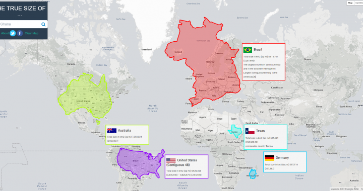
The True Size of Countries
The true size of countries changes our perception of the world. Maps have so many uses in modern society. Google Maps and the navigation included were the main reason I got my first smart phone. But maps have one significant flaw. Every map is a projection of a 3D object onto a 2D plane. That […]
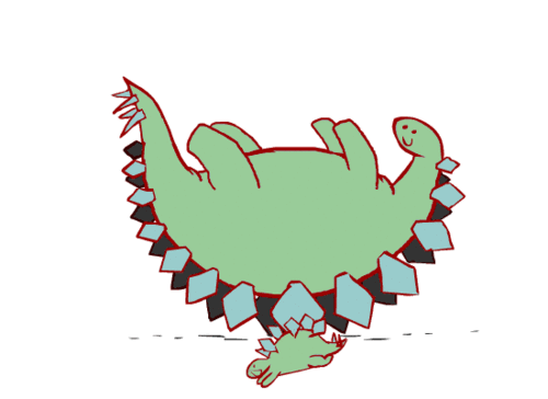
Have a good start in the week!
If you’re grumpy today, just enjoy this comic! If you have any clue, where to find more of these, let me know. My Google Fu didn’t help me find the original author.
Progressing ash plume of Eyjafjallajökull
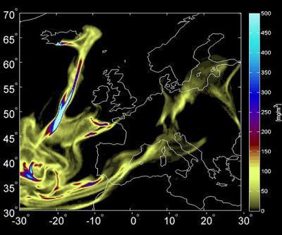
In May 2010 air transportation in Europe came to a halt, when Eyjafjallajökull on Iceland erupted. Now, two years after that eruption scientist have gathered and evaluated all kinds of data how the ash plume moved through Europe. This data taken from satellites, plane and the earth can help evaluate particle dispersion better and limit […]

Seismic Processing – 7 proven tipps to make you a better processor
Seismic data processing is an art and a science. The open source software Seismic Unix has modules for over 20 migration routines, other packages do so as well. Before we get to choosing the best migration routine, there are a couple things anyone handling seismic data should remember. These are 7 Tips from my experience: […]